

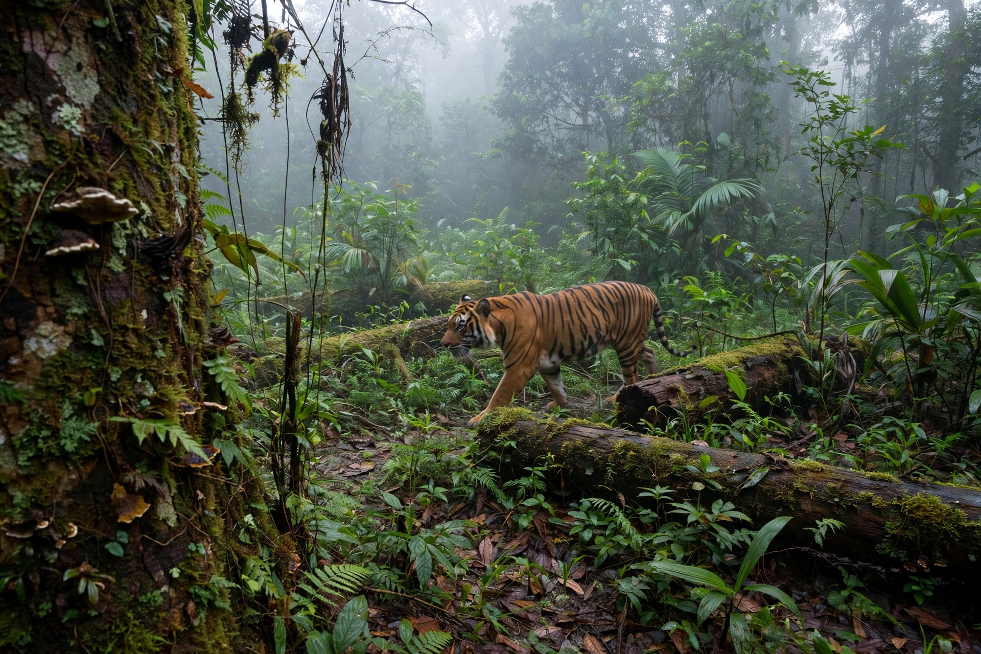
A tiger walks past a camera strapped to a tree in a Sumatran rainforest. Nobody is there to see it. The camera fires, the photo uploads to the cloud, and within seconds an artificial intelligence model names the animal, counts it, and logs the time and place. A decade ago, that same photo would have sat on a memory card for months before a researcher ever looked at it.
That is the idea behind Wildlife Insights, an open access platform built on Google Cloud by a coalition led by Conservation International, the Smithsonian, the Wildlife Conservation Society and WWF. It turns the world’s camera traps into a single, searchable sensor network for wildlife. Fresh coverage landed today, 14 November 2026, when Lightfoot Travel published “How Animal Selfies Are Saving Wildlife”, a look at how the platform is being used to track some of the planet’s rarest animals in near real time.
The scale is what makes it worth attention. The platform now holds more than 34 million camera trap images, recognises more than 3,000 species, and covers projects in 95 countries, according to Vizzuality, the studio that built the platform’s backend on Google Cloud. Google’s own figures say its species identification models can analyse 3.6 million photos an hour, up to 3,000 times faster than a person working through the same images by hand.
What Wildlife Insights Actually Is
Wildlife Insights is a cloud platform for camera trap data, launched in 2020. Camera traps are motion activated cameras that researchers strap to trees and posts in the wild. They photograph whatever walks past, day or night, without disturbing the animals. The method is one of the only reliable ways to monitor shy, nocturnal or wide ranging species, but it creates a data problem: millions of photos and almost nobody with time to look at them.
The platform solves that by combining three things. It stores the images in the cloud, it runs Google’s computer vision models over them to identify what is in each frame, and it standardises the results so researchers anywhere can search, compare and share them. Anyone can upload images, and anyone can explore public projects on the platform’s world map at app.wildlifeinsights.org.
It was built as a partnership, not a product. The founding coalition brought together Google, Conservation International, WWF, the Wildlife Conservation Society, the Smithsonian and others, and the platform is described in a peer reviewed paper by Ahumada and colleagues in the journal Environmental Conservation (2020). The point was to stop every conservation team solving the same data problem alone.
The Problem: Millions of Photos, Nobody to Look At Them
The bottleneck is not collecting photos. It is reading them. A single camera trap can fire thousands of times in a season, and most of what it captures is nothing at all. Wind moves a branch, a leaf falls, and the sensor fires. According to the CASRAI Wildlife Insights guide, typically 60 to 80 percent of camera trap captures are blank frames.
A human reviewer has to open every image, decide whether it shows an animal, identify the species, and record the details. For a project with hundreds of cameras, that takes months. The Zoological Society of London ran into exactly this wall: its teams collect tens of thousands of photographs from each camera trap deployment, and by the time a report on an endangered species arrived, it could be too late to act on it.
ZSL’s answer was to train Google Cloud AutoML models on its own labelled archive images. The models now identify species from thousands of images in days instead of months, and ZSL says the approach could eventually enable real time monitoring of the world’s biodiversity. The manual backlog is the problem Wildlife Insights was built to remove at global scale.
How the AI Works, Step by Step
The platform runs a five stage pipeline, described in detail in the CASRAI guide. Each stage removes a different bottleneck.
1. Project setup and metadata. Teams register their boundaries, camera stations and sensor hardware before deployment. Technicians record camera serial numbers, mounting height, bearing and microhabitat details such as game trails or water sources.
2. Cloud batch ingestion. Researchers upload raw images through web tools or bulk transfer. The platform reads the EXIF headers to verify capture times and camera settings, and automatically flags corrupted files and clock drift.
3. AI vision processing. Deep convolutional neural networks built with Google do two jobs. First they filter out blank frames and separate wildlife from humans and vehicles. Then they propose species identifications from a library of more than 1,200 taxa, drawing bounding boxes around each animal. Google reports that for well represented species such as jaguars, white lipped peccaries and African elephants, the models are right 80 to 98.6 percent of the time.
4. Human review. Researchers check the results in confidence tiers, bulk accepting high confidence identifications and correcting the ambiguous ones. When an image is too poor for a species level call, the identification steps back to genus, family or order rather than guessing.
5. Standardisation and sharing. Validated observations export to a standard schema aligned with Darwin Core and the Camtrap DP standard, and public projects syndicate directly to the Global Biodiversity Information Facility with citable digital object identifiers.
Two safeguards matter. The platform automatically masks precise locations for species listed as Critically Endangered, Endangered or Vulnerable on the IUCN Red List where poaching is a threat, so public records show only the broader project area. And researchers keep ownership of their data, choosing their Creative Commons licence and an embargo period of 1 to 24 months before it becomes public.
The Numbers That Matter
The figures that define the platform come from its builders and from Google, and they tell a consistent story about speed.
- More than 34 million camera trap images in the repository, covering more than 3,000 species across 95 countries, according to Vizzuality.
- 3.6 million photos analysed per hour, up to 3,000 times faster than manual review, according to Google.
- 80 to 98.6 percent identification accuracy for well represented species, according to Google.
- 60 to 80 percent of captures are blank frames, filtered out automatically, according to CASRAI.
- Months of manual review cut to days, according to the ZSL case study on Google Cloud.
No single number proves the system works. Together they describe a tool that has moved from demonstration to infrastructure: the same models, the same pipeline, running for teams on every continent.
Where It Is Working Right Now
The platform’s value shows up in specific places, with specific animals.
In North Sumatra, Conservation International is using camera traps to map the range of the Critically Endangered Sumatran tiger. Its team found footprints of the animals in the 44,000 hectare Batang Angkola Protected Forest, extending the species’ previously known range, with an estimated 400 animals remaining in the wild, according to Lightfoot Travel’s account published today. The camera evidence now gives researchers a basis to argue for extending conservation zones around the forest. The same cameras also record the Critically Endangered Sunda pangolin, sun bears, civet cats and tapirs.
In Cambodia, the team has taken AI enhanced camera traps to Tonle Sap Lake, a habitat for globally threatened and migratory species. The cameras are documenting endangered hairy nosed otters and the elusive Vulnerable fishing cat, evidence that would previously have been almost impossible to gather.
For snow leopards, which range across 12 countries in Central Asia, camera traps are one of the only reliable ways to monitor populations at all, and AI makes it possible to process the huge image libraries those cameras generate. In India and Nepal, AI powered camera networks have produced the most accurate tiger census data ever recorded.
India’s national tiger census shows what camera traps can do at country scale. The 2022 exercise placed camera traps at 32,588 locations, generated 47,081,881 photographs, and individually photographed 3,080 tigers, leading to a population estimate of 3,682 tigers, according to the National Tiger Conservation Authority’s official report. That census runs on India’s own systems, not on Wildlife Insights, but it proves the underlying method: cameras plus computation can count animals that humans almost never see.
Why It Matters Now
The timing is not decorative. WWF’s Living Planet Report 2024 found that monitored wildlife populations fell by an average of 73 percent between 1970 and 2020, based on almost 35,000 population trends across 5,495 species. That figure is an average of population size trends, not a count of animals lost, but it is the clearest available signal that the systems conservation depends on are shrinking fast.
The United Nations’ IPBES assessment in 2019 warned that around one million species face extinction, many within decades. When populations are falling that fast, the difference between knowing a species is in trouble in a month and knowing in a year is the difference between acting and writing an obituary.
That is the real argument for Wildlife Insights. It does not save a single animal by itself. It shortens the distance between an animal walking past a camera and a decision maker who can protect the place it walked through. For species with a few hundred individuals left, that distance is everything.
What the AI Cannot Do Yet
The platform’s own documentation is clear about its limits, and they are worth stating plainly.
Human experts are still necessary. AI accelerates triage by removing empty frames and proposing identifications, but expert review remains essential for rare species, juveniles and occluded images. The system is designed to step back to a broader classification rather than guess when the evidence is thin.
Public data sharing does not expose animals to poachers by default, because sensitive locations are masked automatically, but the masking only works if projects classify their species and locations correctly. The governance depends on researchers using the tools as designed.
And the platform only helps where cameras exist. Vast areas of the planet have no monitoring at all, and no AI can identify animals in photos nobody took. Wildlife Insights makes existing data useful faster. It does not replace the fieldwork.
How to Explore It Yourself
The public side of the platform is open to anyone. The world map at app.wildlifeinsights.org lets visitors browse millions of camera trap images, filter by species, country and year, and see where the data comes from. Researchers can upload their own images and run the identification models over them. The Google Cloud tutorial for building a similar classifier, using a free camera trap dataset, puts the training cost at under 30 dollars per run.
That openness is deliberate. The coalition’s stated goal is recovering global wildlife populations, and it treats shared data as the fastest route there. A camera trap in Sumatra, a model trained in the cloud, and a map anyone can open is a small system. It is also, right now, one of the best working examples of AI doing something plainly useful in the world.
Frequently Asked Questions
What is Wildlife Insights?
Wildlife Insights is an open access, cloud based platform that stores camera trap photos and uses Google Cloud AI to identify the species in them automatically. It was launched in 2020 by a coalition including Google, Conservation International, WWF, the Wildlife Conservation Society and the Smithsonian.
How does Google Cloud AI identify animals in camera trap photos?
Deep convolutional neural networks first filter out blank frames, which are typically 60 to 80 percent of captures, then propose species identifications from a library of more than 1,200 taxa. Google reports accuracy of 80 to 98.6 percent for well represented species, and the models can analyse 3.6 million photos an hour.
How many images and species does Wildlife Insights cover?
The platform holds more than 34 million camera trap images, recognises more than 3,000 species, and covers projects in 95 countries, according to Vizzuality, the studio that built its backend on Google Cloud.
Does Wildlife Insights replace human wildlife researchers?
No. AI removes empty frames and proposes identifications, but expert human review is still required for rare species, juveniles and poor quality images. The system steps back to genus, family or order rather than guessing when the evidence is thin.
Is Wildlife Insights data public, and does it put endangered animals at risk?
Researchers keep ownership of their data and choose a Creative Commons licence and an embargo of 1 to 24 months. Precise locations are automatically masked for species listed as Critically Endangered, Endangered or Vulnerable where poaching is a threat.
How can I see Wildlife Insights camera trap photos?
Anyone can browse public projects on the world map at app.wildlifeinsights.org, filtering by species, country and year. Researchers can also upload their own images and run the identification models over them.
About the Author

Becky Simms
Becky Simms is a technology writer with 9+ years in consumer electronics, streaming services, and device troubleshooting. Becky verifies tech news and outages against official status pages and verified outage reports, covering service outages, AI products, tech companies, and new technology coverage, and separates what is confirmed from what is still unproven. Becky’s guides show readers how to check a service themselves, right now, instead of relying on rumours.
More from Insight Bullion